This episode continues the narrative from the previous instalment, Episode 32, delving into the northern extension of the gold field in the Wuntho District of Upper Myanmar. Furthermore, it offers insights into ongoing gold explorations carried out by both local and foreign companies in collaboration with the Mining Enterprise (2).
Preliminary Report on the Auriferous Tract in the Wuntho District in Burma
The Wuntho District in Sagaing Division has been renowned for its gold deposits since 1899, encompassing the gold fields of Bamauk, Kawlin, and Pinlebu. The Kyaukpazat primary gold mine, situated 26 miles north of Wuntho and 11 miles from Namhkam, the nearest railway station, holds the distinction of being Myanmar’s first gold mine.
In 1995, Ivanhoe Myanmar Holdings, Ltd secured the Kyaukpazat gold block through a bidding process facilitated by the Department of Geological Survey and Mineral Exploration under the Ministry of Mines. The company conducted extensive exploration in Kyaukpazat and its environs, including drilling operations. Unfortunately, Ivanhoe eventually abandoned the Kyaukpazat prospect due to unfavourable economic outcomes. During this exploration phase, I served as the secretary of the Joint Coordination Committee between DGSE and Ivanhoe, overseeing the progress and outcomes of the Joint Venture company. However, I did not have the opportunity to visit the Wuntho Kyaukpazat mines area during my tenure with DGSE.
Following my early retirement in 2005, I was appointed as a consultant geologist by Ruby Dragon Mining Co, the proprietor of the Kyaukpazat gold field. I was fortunate to work at this renowned gold mine and explore other promising prospects. Despite the abandonment of the old Kyaukpazat mine, which had collapsed in some parts of the tunnel and shafts, my studies led me to believe that there may still be remaining economic ore reserves in the surrounding areas.
During Ivanhoe’s tenure, a significant number of drill holes were sunk based on previous records, but they failed to interest gold-bearing quartz veins of economic significance. Similarly, during my tenure with Ruby Dragon, we encountered challenges due to the brittle nature of the highly pyritic gold-bearing quartz veins, which varied in thickness from 0.3m to 3m. The rapid passage of quartz vein fragments often led to drillers’ oversight, potentially contributing to Ivanhoe’s decision to abandon the prospects.
Under Ruby Dragon Company’s management during my tenure, three producing mines with high-grade gold were operational. It became evident that gold prospects were associated with Tertiary consolidated and well-stratified tuffs and breccias of andesitic character, occasionally intruded by quartz-diorite. While the veins were intermittently clean, they were typically well mineralized, containing five per cent chalcopyrite, pyrite, galena, and franklinite. Altaite, a relatively rare telluride of lead, served as a favourable indicator of gold presence (Chhibber, 1934). Remarkably, during my tenure with Ruby Dragon, the average monthly gold production ranged between 13.04 kilogrammes and 16.30 kilogrammes.
During my tenure as Project Manager at Care Mineral Corp. of Switzerland from 2006 to 2012, I spearheaded gold and copper exploration efforts in Legyin and Khanpat gold prospects, both of which are situated as northern extensions of the Kyaukpazat gold deposits. Subsequently, as a consultant geologist with KBZ Power Mining Co from 2012 to 2014, I furthered exploration activities in the Khonan prospect. Despite the geological and mineralization similarities shared with Kyaukpazat, Care Mineral Corp faced several obstacles preventing progression to the production stage. Similarly, KBZ Power Mining encountered challenges in acquiring the Khonan Prospects, which constitute the northern extremity of the Kyaukpazat gold deposit, largely due to complex policy issues.
Regarding the auriferous tract in the Wuntho District in Burma, mining specialist G. A. Stonier of the Geological Survey of India documented the Kyaukpazat and Legyin gold deposits in 1899-1900. His report provided significant insights, which can be summarized as follows:
During the field season of 1899 to 1900, I was engaged in investigating the conditions under which minerals (particularly gold) occur in the district bounded by Bamauk on the north, Kawlin on the south, Seu on the east, and Pinlebu on the west. I have done as much original prospecting as was possible during the time at my disposal, but the work was seriously impeded by the desire for skilled labour to carry out ordinary methods of prospecting, such as those adopted in America and Australia.
During the month of February, I was employed in detailed prospecting work, a close study of the Choukpazat (Kyaukpazat) lode (underground and on the surface), and the survey of several traverses which were necessary on account of the incomplete character of the plans supplied to me.
Choukpazat
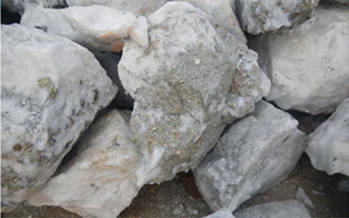
Burmans discovered the Choukpazat reef, and they worked the outcrop to a depth of 8 to 10 feet. Mr C M P Wright, who was prospecting in the neighbourhood in 1894, came to these old excavations, and after a series of tests, he discovered the shoot of gold and commenced to sink upon the reef. To illustrate the difficulties connected with the preliminary proceedings, it may be mentioned that, at one time, the strike of the vein was believed to be north and south, and it was only by a considerable amount of work that the direction was found to be E 30 ͦ N, and the underlying to be S 30 ͦ E at 62 ͦ. The vein has been proved to a depth of 420 feet, though all the slopes are above the 310 feet level. The length of the vein is 240 feet, and the richest part of the deposit has been found midway between the northeastern and southwestern boundaries. The thickness varies from two inches to ten feet and averages about three feet six inches. The veinstone contains 14 dwts of gold to the ton of stone and consists chiefly of compact quartz, generally white in colour, but in places banded with black streaks which are roughly parallel with the walls of the vein and show very clearly by candlelight in the mine. The quartz varies considerably in character and below the 310 feet level is associated with calcite: in places, it is devoid of an accompanying mineral, but in other parts of the vein, there is so much galena, copper pyrites, and iron pyrites present that the ore has the appearance of a complex copper ore.
The free gold is fine, irregular in occurrence, and is most abundant where altaite (telluride of lead, tin-white in colour) is present: it is frequently associated with copper pyrites and is visible at the 310-foot level. Unless the character of the stone is known, a heap of milling ore may be examined without a single “specimen” being discovered; under the circumstances, it is needless to add that miners do not steal specimens.
The footwall and hanging wall are sometimes well-defined, and the latter is polished and occasionally striated. “Horses” (i.e., included country) are of common occurrence and have been found to carry payable gold. “Breaks” are met with in the footwall and less frequently in the hanging wall.
The vein is cut off on the southwestern end by intrusive felsite(?), a description of which must await microscopic examination. The vein thins as it approaches this rock and passes into a small mullocky vein at the junction of the intrusive and intruded rocks. At the northeastern end, the lodestuff appears to be cut off at the outcrop by a fault, but in the Main Adit (94 feet level) there is no sign of a fault, and the vein gradually thins until it cannot be traced even as a division-plane traversing the country. Below the Main Adit, the levels have not been extended in a north-easterly direction from the main shaft, which latter is wholly in ore. It is of considerable importance that the mine should be proved, not only in-depth but also in the horizontal direction indicated.
Attempts to trace the extension of the view beyond the auriferous shoots have failed both in a north-easterly and south-westerly direction.
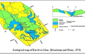
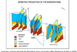
Specimens sent by Mr Wright from the hanging wall at the 310-foot level have been examined by Messrs. Middlemiss and Holland, both of whom report it to be a “pyroxene”. I think that both the hanging wall and footwall belong to the series, which is the tuffs, a series largely developed in the district. The rocks have the general appearance of sediments, although it was impossible to obtain evidence of their sedimentary origin – the sections are poor. In some respects, the rocks resemble a thick series of tuffs, breccias, etc., of Devonian age, which I discovered at Bingera (New South Whales). In the absence of paleontological evidence, I should consider the Choukpazat rocks to be as old as the Australian beds referred to.
Within 75 yards of the outcrop of the Choukpazat vein, intrusive diorite has been found: a specimen, selected by me, has been examined microscopically by Mr T H Holland. This rock can be traced northerly along the Choukpazat Stream, where it is found at intervals of a distance of one mile.
A mass of diorite occurs at Shintha, four miles north of Choukpazat village, and appears to be on the same line of disturbance. Taking into consideration the wavy line of junction, the occasional (perhaps even frequent) alteration of the tuffs at the junction, and the thin tongues of diorite penetrating the tuffs, there is no room for doubt that the diorite is of a later age and intrusive into the tuffs.
The evidence for the relation of the felsite to the tuffs is not as satisfactory but is, I think, sufficient to establish the intrusive character of the felsite. At about one mile south of Choukpazat village, a good section is seen: porcellanites rest vertically on felsite, which is indistinctly schistose in places.
The mode of occurrence of the quartz and its association with calcite show that the quartz, occurring in the vein, is not interbedded but is younger than the enclosing rocks and has been deposited from solution. The question will be more fully dealt with in a subsequent report.
Half a mile in a northerly direction, a quartz reef (parallel to and in the same country as the Choukpazat vein) has been discovered but has not been prospected.
Nine hundred yards to the north-north-east, two quartz veins have been found. One, known as the Peregrine, has been cut by an adit 136 feet long, and a level is being driven N. 10 ͦ W. in a direction along the vein which varies from 12 to 16 inches in thickness: a quantity of ore has been raised, and awaits treatment. Seventy yards west-north-west of the Peregrine adit, a vein known as the Masheeboo has been cut in a level driven 24 feet S. 51 ͦ E. and N. 51 ͦ W. from an adit ninety-five feet long. The reef is seen only at the western end of the level and varies from an inch to a foot in thickness. A parcel of ore is being raised.
The mill is situated on the Nevalabo Choung, one mile north of Choukpazat village, and consists of a ten head stamps battery (750lbs. stamps, 7-inch drop, 92 blows per minute, .02-inch screens) with ordinary amalgamated copper plates and two small shaking tables: nine dwts. of gold per ton are obtained by amalgamation. Concentrates are collected on two Frue Vanners and are being stored with a view to the erection of a suitable plant for their treatment. The tailings contain 3 dwts. of gold per ton: a small cyanide plant is being erected to deal with them. The following table illustrates the method: –
See page- 12
There is no doubt that free gold will be found in the auriferous shoots at greater depths than 420 feet, to which the Choukpazat vein has been proved. This feature is important because it means that a fair percentage of the gold in most of the workable lodes can be extracted with the aid of simple machinery. Only one complete plant is necessary for the district, and the concentrates from the smaller mines could be sold on assay value to the owners of the larger plant. There has not been as favourable an opportunity as the present for the development of small mines: a comparatively small addition would make the Choukpazat plant suitable for the purpose indicated.
Legyin
Eleven miles north of Choukpazat, an area is being prospected for by Mr N Lazarus. Several quartz veins have been discovered, and a level of thirty-four feet in length has been driven along a reef bearing northwest and heading 10 degrees to the southwest. The reef varies from 15 inches to 2 feet in width, is well defined and worthy of exploitation. The other veins referred to have not been prospected. Legyin was a base camp of Care Minerals Corp. during 2005 and 2006.
Conclusions
The two properties described in this report are the only places where work is in progress, and as will be seen from my remarks, only one payable vein has been found to date.
References:
1. Stonier G A 1899-1900: Preliminary Report on the Auriferous tract in the Wuntho District in Burma, Rec of GSI, general report 1899-1900.
2. Chhibber H L 1934: The Geology of Burma, University College, University of Rangoon.
3. Than Htun 2012: Khonan Gold Prospect in Bamauk Township, an internal report of KBZ Power Mining Co Ltd.
